At first glance it may seem that all Civil 3D survey databases are created the same. In fact, maybe you have come to the realization that assigning a coordinate system, units, angle precision (among other settings) is a necessary step in the workflow for each new database.
Fortunately, this isn’t the case! With a little work, we can change the default settings applied to each new survey database such that it reflects our typical choices.
Here’s how…
On the Survey Tab, right click on an existing survey database that represents a “typical” project and choose Edit Survey Database Settings.
This will open the Survey Database Settings dialog box.
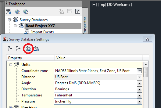
In the illustration below, I’ve selected my Road Project XYZ database. This database uses an Illinois State Plane Coordinate system (typical for my area).
Notice the two “survey” icons at the top of the dialog box.
The one circled in red is used to EXPORT the settings to a file.
Click the icon and save the settings to your desktop for now.
(I’m going to call mine JWB_TYP_SETTINGS.sdb_set)
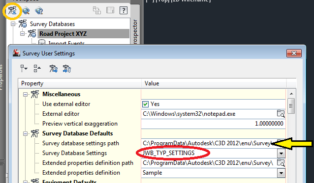
Next, open the Survey User Settings
(Click the icon circled in ORANGE below)
Note the Survey database settings path marked with the yellow arrow.
You need to place your saved settings file within this folder.
After doing so, you can select your custom settings using the Survey Database Settings flyout below.
When finished, click okay to dismiss the dialog box.
From this day forth, all new survey databases will use your customized “typical” settings.


Leave A Comment