
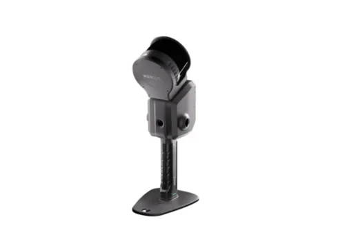
The XGRIDS L2 Pro 32/300 Standard Package, available through Seiler Design Solutions, offers high-precision LiDAR mapping and surveying with an extended 300-degree field of view for superior data capture.
XGRIDS L2 Pro 32/300 Standard Package
Description
The XGRIDS L2 Pro 32/300 Standard Package, offered by Seiler Design Solutions, is a cutting-edge LiDAR system designed for high-accuracy mapping, surveying, and geospatial data collection. Featuring 32 channels and an expansive 300-degree field of view, this system delivers high-density point clouds, making it ideal for applications such as infrastructure planning, forestry management, and large-scale topographic surveys. Engineered for precision and efficiency, the L2 Pro 32/300 seamlessly integrates with drone platforms, ensuring exceptional data accuracy and workflow optimization for professional users.


Reviews
There are no reviews yet.